George Local Municipality (George)
 |
The municipality covers an area of 5191 km2 in the Garden Route and Little Karoo regions. It includes the coastal plateau around the city of George, and extends northeast over the Outeniqua Mountains to include the eastern end of the Little Karoo as far as the Swartberg mountains and the boundary with the Eastern Cape province. It abuts on the Mossel Bay Municipality to the west, the Oudtshoorn Municipality to the northwest, the Dr Beyers Naudé Municipality to the northeast, the Kou-Kamma Municipality to the east, and the Bitou and Knysna Municipalities to the southeast.
According to the 2011 census the municipality has a population of 193,672 people in 53,551 households. Of this population, 50.4% describe themselves as "Coloured", 28.2% as "Black African", and 19.7% as "White". The first language of 67.2% of the population is Afrikaans, while 21.7% speak Xhosa and 8.1% speak English.
The majority of the residents of the municipality are in the city of George, which as of 2011 has a population of 157,394. Close to George are the coastal resorts of Herolds Bay (pop. 704) and Wilderness (pop. 6,164). Haarlem (pop. 2,376) and Uniondale (pop. 4,525) are in the interior of the municipality at the top of the Langkloof.
Map - George Local Municipality (George)
Map


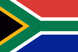
Country - South_Africa
 |
 |
| Flag of South Africa | |
About 80% of the population are Black South Africans. The remaining population consists of Africa's largest communities of European (White South Africans), Asian (Indian South Africans and Chinese South Africans), and multiracial (Coloured South Africans) ancestry. South Africa is a multiethnic society encompassing a wide variety of cultures, languages, and religions. Its pluralistic makeup is reflected in the constitution's recognition of 11 official languages, the fourth-highest number in the world. According to the 2011 census, the two most spoken first languages are Zulu (22.7%) and Xhosa (16.0%). The two next ones are of European origin: Afrikaans (13.5%) developed from Dutch and serves as the first language of most Coloured and White South Africans; English (9.6%) reflects the legacy of British colonialism and is commonly used in public and commercial life.
Currency / Language
| ISO | Currency | Symbol | Significant figures |
|---|---|---|---|
| ZAR | South African rand | Rs | 2 |
| ISO | Language |
|---|---|
| AF | Afrikaans language |
| EN | English language |
| ST | Sotho language |
| SS | Swati language |
| TS | Tsonga language |
| TN | Tswana language |
| VE | Venda language |
| XH | Xhosa language |
| ZU | Zulu language |